
WHAT IS 4D IMAGING RADAR?
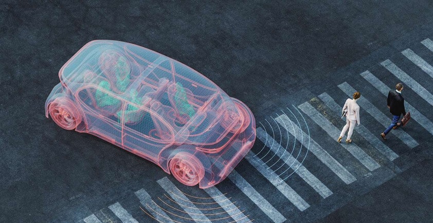
4D imaging radar is high-resolution, long-range sensor technology that offers significant advantages over 3D radar, particularly when it comes to identifying the height of an object. This technology is important in the development of advanced driver-assistance systems (ADAS) for some Level 2 and 3 functions, and is a key enabler for Level 4 and 5 automated vehicles.
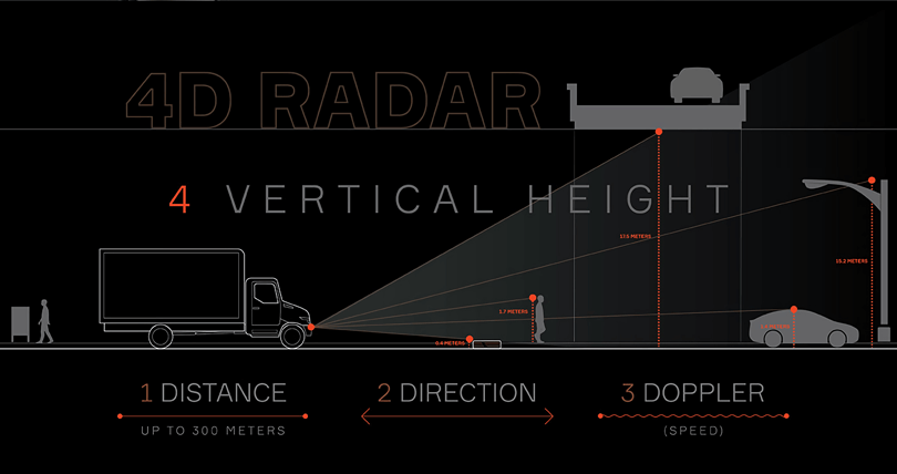
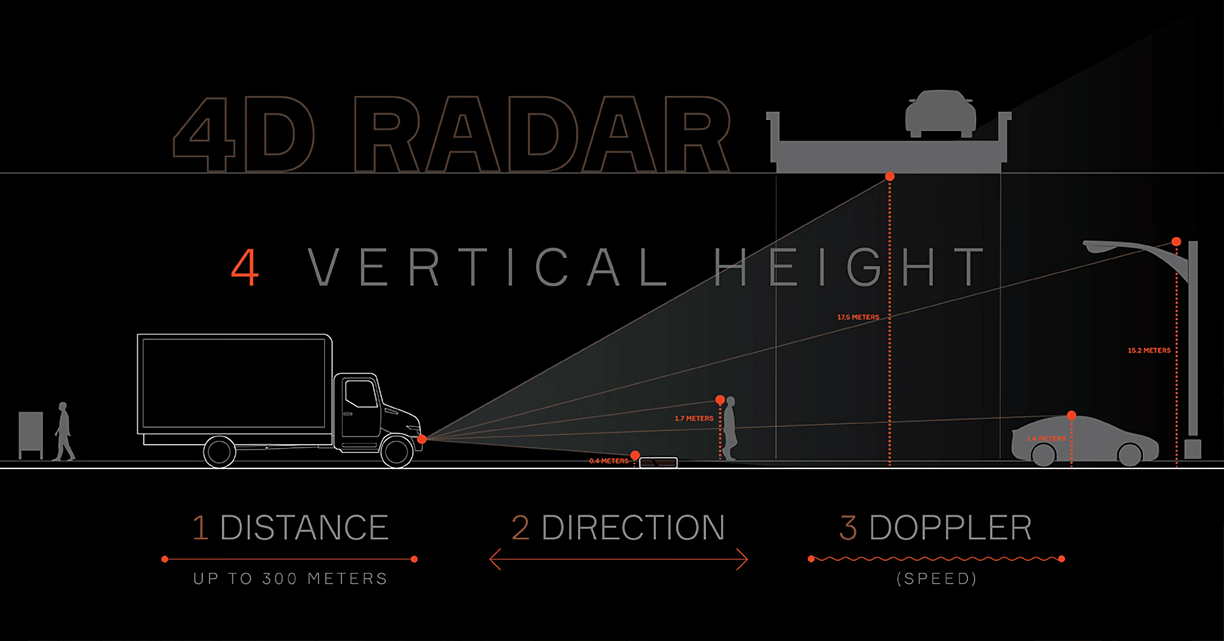
Traditional radar systems are adept at scanning the roadway across the horizontal plane and identifying the "three D’s" of an object: distance, direction and relative velocity (Doppler). Newer 4D imaging radar systems add another dimension: vertical information. These devices get the "imaging radar" label due to the richness of the data they return; that is, with both horizontal and vertical data, the radar can detect many different reflection points, which, when mapped out, begin to resemble an image.
Knowing how tall something is, or how high an object is above the roadway, is crucial in a variety of real-world scenarios. For example, when a truck is approaching a bridge underpass, 4D radar can determine whether the vehicle can safely fit under it, or whether there is a vehicle parked under the bridge.
In automated driving scenarios in which the driver might not have his or her hands on the wheel or might not be fully alert to driving conditions, 4D radar is superior to 3D radar in identifying objects in the roadway at long distances and helping the vehicle decide the appropriate action to take. Is that an obstacle on the roadway or an overhanging street sign? Is that a cyclist near the guardrail or does the road just narrow?
In addition, 4D imaging radar is better at identifying road contours and boundaries and distinguishing between an object in the road, a low curb, or a seam in the concrete. And it works better than 3D radar in identifying multiple objects in dense traffic conditions.
How it works
There are two aspects to a 4D imaging radar system: the data collection and the data processing.
To collect data, typical radar systems use an array of antenna elements, each with a wide beam. They can then digitally combine those to create an array of narrow beams – through a process known as digital beamforming – which improves the resolution of the resulting image. The difference between 3D and 4D radar is in the arrangement of these antenna elements. A 3D radar system has antennas arrayed horizontally, whereas 4D radar has elements arrayed both horizontally and vertically.
Processing the data into actionable information can occur within the radar system itself utilizing existing approaches; Aptiv sends this more precise data to a multi-domain controller, using our Satellite Architecture, and applies machine learning techniques to best interpret the scene and build an environmental model.
Aptiv’s FLR4 next-generation forward-facing radar doubles range resolution and triples the vertical field of view over previous models. Aptiv’s FLR4+, the company’s first 4D imaging radar, offers range detection at up to 300 meters and supports true elevation target discrimination with machine learning.
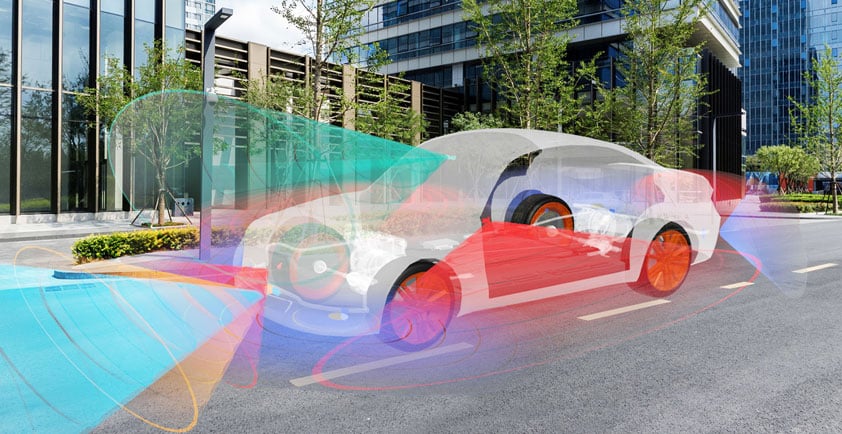
Even the most advanced 4D imaging radar doesn’t work in a vacuum, however. It is part of an integrated system of sensors that takes advantage of the strengths of each sensing technology. The system can use sensor fusion to weave together data from those various sensors to create a cohesive picture of the environment around the vehicle.