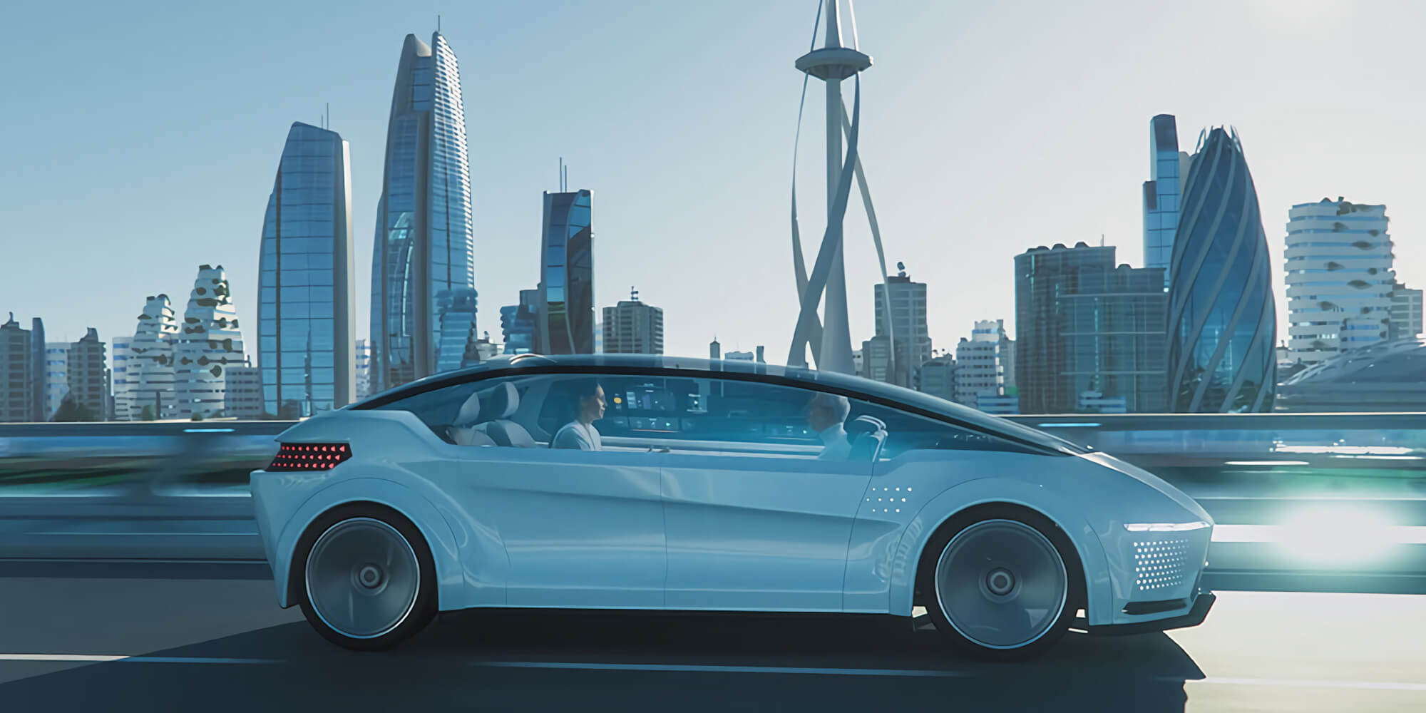
EMERGING TECHNOLOGIES IN AUTOMOTIVE
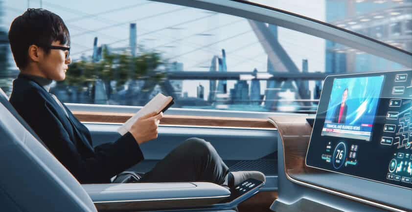
Always online, constantly communicating, and software upgradeable over the air, our cars are morphing into smartphones on wheels.
Innovation is apace in the automotive industry. Synthetic fuels, electric drive trains, and new ways to store the electricity they need are transforming the car as we know it. Innovative ownership models, driverless delivery vehicles, and robo-taxis are disrupting well-established businesses, forcing them to adapt to a radically transformed landscape. And advanced driver assistance systems, next-generation human-machine interfaces, and driver-monitoring systems are redefining our relationship with our cars.
Behind many of these innovations lies the head-on collision between the automotive industry and the Internet of Things, which is transforming vehicles from chefs-d’oeuvres of mechanical engineering to masterpieces of software-hardware integration. Chief among the technologies plucked out of the IoT’s toolkit: extensive sensing, data analytics, and real-time decision making. Not to forget the glue that holds it all together: communication, largely wireless – within the vehicle, beyond it, and all the way up into the cloud. Call it an evolution or a revolution. Either way, it will be transformational.
Vehicle-to-everything communication
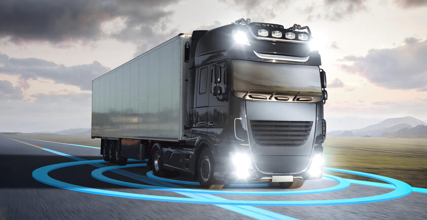
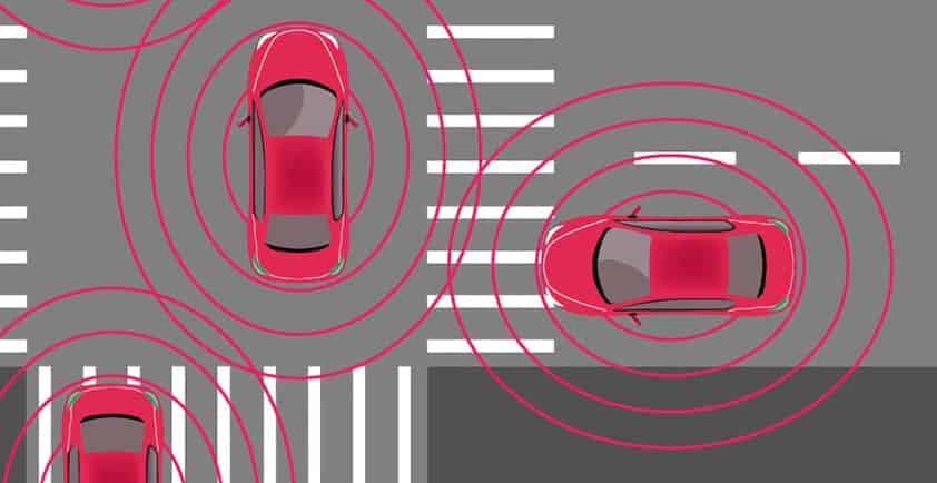
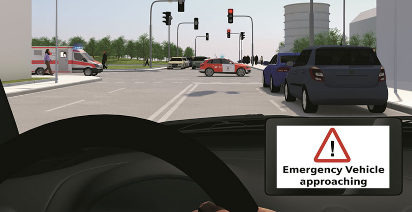
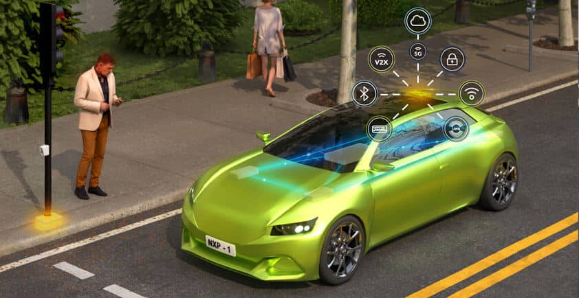
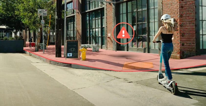
It was only a matter of time before vehicles would be able to communicate with their surroundings. And while it has been long in the making, it is quickly becoming first a reality, then the norm. The list of use cases comprised in the term V2X (vehicle-to-everything) is long. Vehicle-to-vehicle communication will let vehicles exchange information with each other to increase road safety by negotiating dangerous maneuvers, relaying early warnings of obstacles, or sharing camera feeds and other sensed data in real-time beyond line of sight, essentially allowing them to see around corners.
Vehicle-to-network communication will provide a constantly open data pipe to the cloud to share sensed data pertaining to the vehicle with the OEM’s quality assessment teams, and to crowdsource data on the traffic conditions and deliver them to third-party service providers. Vehicle-to-infrastructure communication will help orchestrate traffic flow, manage intersections, and flag potential safety hazards to protect drivers, in the same way that vehicle-to-pedestrian communication will make vehicles aware of those most vulnerable on the streets. Crucial at every step of the process: precise and trustworthy location data on all the vehicles comprising the intelligent transport system, and reliable information on their status.
Individual vehicles will not only become part of the overall traffic system. With vehicle-to-grid communication, battery-powered electric vehicles will also become a critical component of smart power grids, which are already having to deal with managing a greater share of highly intermittent renewably generated power. By offering massively distributed power storage capacity to absorb electricity when produced in excess and release it again to smoothen peaks in demand mediated by V2G communication, electric vehicles, and the batteries they carry, will help stabilize the power grid.
5G
Smartphone users aren’t the only ones excited by the prospects of the record-shattering performance specs promised by the 5th generation of cellular communication technology (5G). Its increased capacity and higher data rate are expected to level up in-vehicle infotainment services, offering new services such as real-time gaming, real-time audio and video streaming, and more. Automotive OEMs and Tier 1s have been at the drawing table as members of the 3GPP shaping the development of 5G since day one. As a result, cellular communication, 4G today and 5G in the coming years, is poised to become the main communication channel for V2X, particularly in the US and China.
Some basic V2X use cases have already been implemented using 4G C-V2X; 5G specifications address the needs of more advanced ones. Vehicle platooning, for example, enables trucks to travel in dense convoys, considerably reducing fuel consumption by minimizing drag. Extended sensors let vehicles access the cameras and other sensors on vehicles in their vicinity, allowing them to extend their field of view and increase safety through what is referred to as "collective perception." And remote driving, which leverages 5G’s ultra-reliable low end-toend latency capabilities, will allow professional drivers to pilot vehicles from afar.
The C-V2X sidelink communication feature enables direct device-to-device communication, allowing vehicles to communicate directly with each other, with roadside infrastructure, or with other traffic participants. In 3GPP Release 17, this feature will be further enhanced to support new radio (NR) sidelink replay to extend coverage and improve power efficiency. And, additionally, it will include a dedicated power-saving mode to implement vehicle-to-pedestrian communication that doesn’t drain pedestrians’ smartphone batteries.
5G has a prominent role to play in positioning for automotive applications. In particular in dense urban canyons, it could complement GNSS-based positioning, enhancing positioning performance by leveraging the expected dense base station networks to deliver highly accurate location services. By analyzing the time difference of arrival of cellular signals from multiple base stations, receivers will, for example, be able to determine their position relative to them using multilateration, while advanced approaches using antenna arrays could be used to implement angle-of-arrival and angle-of-departure based positioning solutions.
Real-time high-definition maps
Cameras and lidars are heavily relied upon by autonomous vehicles to perceive their environment, detect obstacles, and inform decisions on the safest way to reach the intended destination. In order to determine their absolute position in space, the vehicles’ autonomous driving computers can match up the data they sense with a high-definition (HD) map of their surroundings, which offers a detailed representation of the surrounding environment. SD maps, offering meter-level resolution, have long been used by OEMs to enable features such as speed assist and predictive powertrain control of trucks to reduce fuel consumption by anticipating upcoming curves and slopes on the road and other functions related to automatic cruise control. HD maps, which are required to implement advanced ADAS Level 2 and Level 3+ features, demand decimeter-level accuracy of the map, as well as of the position of the vehicle and surrounding objects. To ensure that the data can be used by the autonomous driving systems of as many vehicles as possible, HD maps are typically designed to comply with the ADASIS v3 interface specification, which is the de-facto industry standard used by OEMs around the world.
As the central repository of static geographical information surrounding the vehicle, the trend is for HD maps to increasingly take advantage of low-latency and reliable data links to deliver dynamic information as well. To this end, they will have to be continuously updated, crowdsourcing data from as many vehicles’ sensors as possible, and making it available to vehicles around them. To do so, vehicles will be able to publish relevant information from their sensors to the base map, which is made available on the cloud.
Accurately positioning obstacles detected by vehicles on the HD map is essential, yet challenging, in particular when traveling at high speed down a highway lacking obvious landmarks. High precision satellite-based positioning becomes a necessity to first accurately and reliably locate the vehicle itself, determine the relative position of other obstacles, and warn nearby vehicles.
Sensor fusion
No single sensing technology can come close to matching the performance of a human driver. Human brains intuitively combine a broad variety of inputs to draw meaningful conclusions. Machines need to be instructed precisely how to fuse the data their sensors gather, leveraging expertise more commonly available in data-heavy industries than in the traditional automotive sector. But when well done, sensor fusion allows to increase the reliability of sensed data and extract information that only becomes available when multiple sensors are used in conjunction.
Positioning is one area that can benefit from sensor fusion. Accurate satellite-based positioning requires constant line of sight between the vehicle and the orbiting GNSS satellites. Underpasses, tunnels, dense forests, mountainous terrain, and urban canyons can all degrade positioning performance, ultimately leading to signal loss in indoor environments. By augmenting satellite-based positioning with inertial sensor measurements used to reconstruct the vehicle’s trajectory in dead reckoning solutions, intermittent gaps in GNSS coverage can be bridged.
This approach can be extended further by incorporating camera, lidar, and radar data that allow the vehicle to position itself relative to landmarks, as well as using the HD map, and potentially indoor positioning solutions based on ultra-wideband, short-range, or cellular communication technology. Together, these complementary solutions can extend the availability and coverage of reliable and precise positioning to a broad variety of environments.
By taking advantage of redundancies, sensor fusion can also help stabilize the vehicle’s overall sensing performance. Sensors can drift, go offline, or fail altogether. By constantly cross-checking the input across sets of sensors, machine learning algorithms can be trained to detect incongruities and flag sensors that cannot be relied on. While the situation may be easily remedied by recalibrating the sensor in question on the fly, it could also signal that the sensors are deliberately being jammed or spoofed by hackers.
Augmented and virtual reality
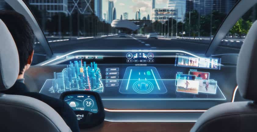
Augmented reality is transforming in-vehicle infotainment systems by projecting relevant information right into the driver’s field of view. Mercedes Benz, for instance, already offers an advanced AR heads-up display in some of its latest vehicles, providing information on the speed limit, the driving speed, and GPS navigation instructions Panasonic has presented its latest heads-up display solution, offering crisp 4K projection that follows the gaze, delivering even more content, including advanced collision detection to increase traffic safety, visual highlights of relevant environmental information, and easy-to-follow navigation instructions to help keep the driver’s eyes focused on the road.
Unlike augmented reality, which superimposes artificially generated information into a user’s field of view, virtual reality fully immerses users into a virtual world. Innovative companies, such as holoride, have found creative ways to leverage high data rates and low latencies to build next-generation passenger entertainment solutions: Using a headset, passengers can experience their journey as a first-person adventure game in which the hero’s movements are perfectly synched up with the car’s motion. We often forget that our smartphones can make phone calls. If holoride’s immersive experiences catch on, we might forget that our cars were originally designed to get us places.