HELPING DRIVERS STEER CLEAR OF HIGHER RISK ROADS
Whether on the school run, going to work or doing the weekly shop, we are all familiar with stretches of road or locations where more care is needed while driving. In some cases, we may choose to avoid them altogether to help ensure our journeys are completed safely.
Now, we have developed the new "RoadSafe" concept which could help alert drivers to higher risk locations and make insights of this kind available to local authorities so that they might do something about them.
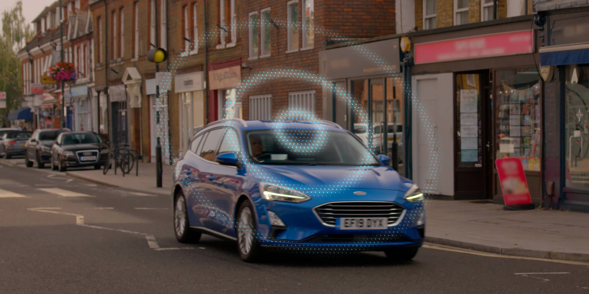
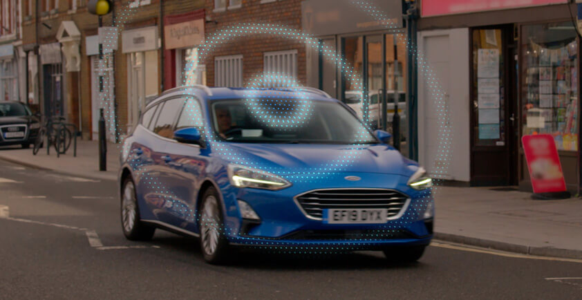
A smart algorithm crunches anonymised data from sources including connected vehicles, roadside sensors and accident reports in order to pinpoint where there is a higher chance of traffic incidents occurring. This information can then be displayed on a map that identifies the level of risk and could also be used to warn drivers of hotspots.
"There are areas in every city where the chance of an incident is higher, whether it’s due to a poorly placed sign, an unrepaired pothole or junctions built to accommodate far less traffic than we have today. Now, Ford can pinpoint the areas of concern, so drivers could be made more aware of them and authorities can address them."
Jon Scott, Project Lead, City Insights, Ford Mobility, Europe
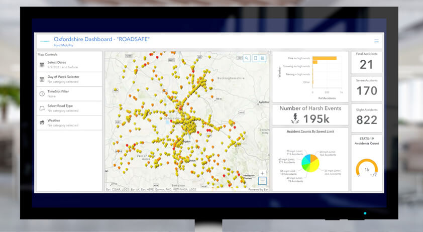
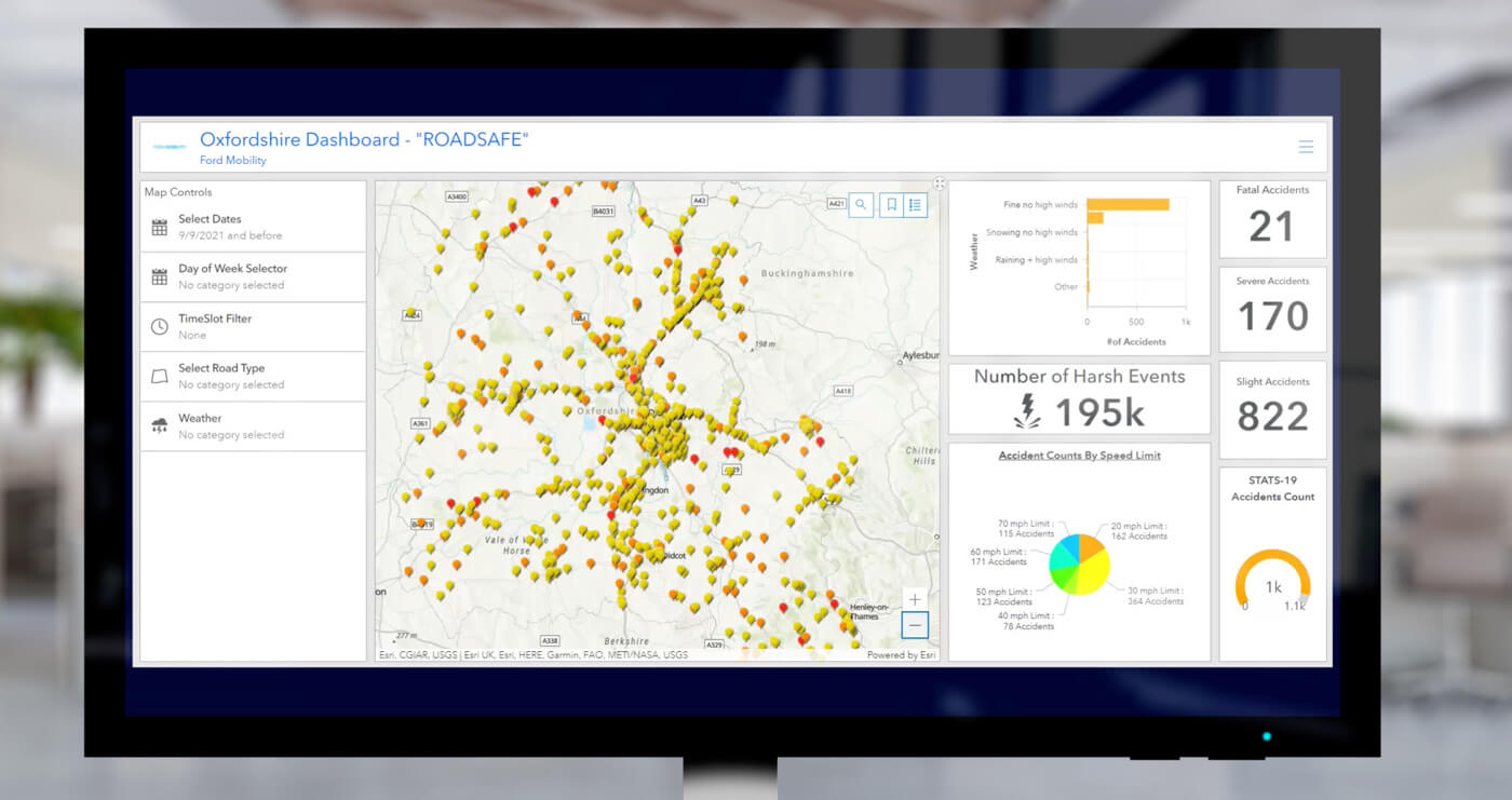
The "RoadSafe" dashboard features a "Road Segment Risk Prediction" rating that uses colours to show where incidents are more likely to happen, with red having the highest risk level and yellow the lowest.
This digital tool is the culmination of four years of research, including most recently a 20-month government-funded project we conducted together with Oxfordshire County Council, Loughborough University and AI sensor specialists Vivacity Labs, with support from Transport for London and backing from Innovate UK.
To gather the data, the connected vehicles record driving events, including braking, steering and accelerating, while Vivacity’s road-side sensors track the movements of different modes of transport.
Combining vehicle and sensor data can help identify a wide variety of hazards such as places where vehicles pass too close to cyclists; a poorly located bus stop causing traffic to become congested; and badly designed infrastructure such as a roundabouts and junctions causing confusion and near-misses.
Universally applicable and scalable for areas ranging from large cities to small towns, "RoadSafe" could have a significant impact on the number of road incidents.